
Spanaway Neighbors by Source
Public records describe land, filings, civic roles, and voter data under set rules. They do not provide one complete roll of every person on a Spanaway block. Start with the source that answers the narrow question. PublicGIS outlines adjacent parcels. ATIP supplies parcel and tax attributes. Recorded documents can identify parties to deeds or covenants. Association sites may show officers or a public contact, not all neighbors.
| Source | What It Shows About a Block | Access |
|---|---|---|
| PublicGIS | Parcel boundaries, nearby lots, roads, schools, public safety, utilities, and clicked attributes | Free web map; features are approximate |
| ATIP parcel search | Parcel number, site and mailing fields, taxpayer, plat, value, use, and exemptions | Free dynamic portal |
| ARM and Digital Archives | Deed parties, covenants, plats, legal descriptions, and recording dates | Free index; image and copy access varies |
| Pierce voter data | Precinct or district records and participation history when requested | Restricted use, request form, and fees |
| Association and civic pages | Public board contacts, meetings, projects, and community boundaries described by the group | Public pages; member details may be private |
| Local-history collections | Earlier household, building, address-change, and newspaper clues | Library, archive, and licensed databases |
The taxpayer listed on a parcel may live elsewhere, and county metadata says that field is not a positive ownership determination. A delivery address is not the site address. Even a deed names parties to a recorded transfer, not everyone present today. Keep each record tied to the parcel and date it actually describes.
Map Spanaway Neighbor Blocks
Pierce County PublicGIS lets a reader zoom to a Spanaway address, turn on the Parcel layer, click a feature, and inspect its attributes. The map also offers categories for schools, places of interest, political boundaries, public safety, transportation, utilities, and environmental data. Use only the layers relevant to the question so parcel lines remain clear.
No one-click radius or buffer tool was confirmed in the official inspection. To map the immediate block, click the target parcel and each lot that shares an edge or sits directly across the street. Copy the parcel number and site address from each result. Map features are approximate. A survey or recorded plat controls when an exact boundary matters.
Info By Address offers another entry point with an address field or a map click. If the spelling fails, try the parcel number from ATIP and preserve directional letters, street suffix, unit, and postal city exactly. Spanaway-area county pages use both Spanaway and Tacoma mailing labels, so a city-name mismatch alone does not rule out the parcel.
Map Spanaway Neighbors by Parcel
A reliable block search moves from geography to records. Do not begin with a list of names. The parcel number is the stable key shared by the assessor, GIS, permits, plats, and many recording references. Keep a small row for each nearby lot so information from one address never drifts onto another.
- Enter the full site address in Info By Address or PublicGIS. Confirm the mapped road, lot shape, and parcel number.
- Click each lot beside and across from the target. Record its parcel number and physical site address.
- Open each parcel in ATIP. Keep taxpayer, delivery address, site address, plat, use, and values in separate fields.
- Use the plat or legal description in ARM when a covenant, easement, or recorded association document may apply.
- For every parcel along the full road, switch to the Spanaway street directory workflow.
The flow is simple: address to map, map to parcel, parcel to public attributes, then parcel or plat to recorded documents. It identifies land records around an address. It does not establish that the taxpayer, deed grantee, or mailing contact is a current occupant.
- Parcel
- A county tax and mapping unit with its own identifier.
- Site address
- The physical location attached to the parcel.
- Delivery address
- The mailing address on the taxpayer record, which may be elsewhere.
- Plat
- A recorded map that divides land into lots, blocks, roads, or other areas.
Spanaway Neighbors and Associations
Association pages add public civic context after a parcel or recorded covenant identifies the right group. They are not resident directories. Three Spanaway-area groups illustrate the range: one posts officers, one describes its meeting pattern, and another protects some contact details behind a member login.
Augusta HOA
Official association site
Public officers and a mailing box. Confirm parcel coverage through recorded plat or covenant documents.
Sunset Acres HOA
Community site
Describes large-lot phases, dues timing, and open member meetings without publishing a household roll.
Whitewater Estates
Public contact page
Located near 337th Street South and Spanaway-McKenna Highway; some email details require member access.
The captured Augusta HOA page shows the public board and contact layer available to Spanaway neighbors.
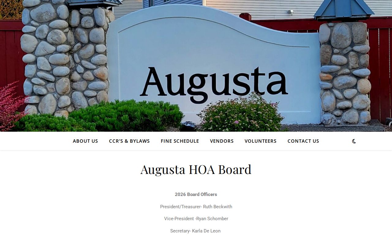
Use those public contacts for association business, then respect any member-only boundary shown by the group.
A board page identifies a public role, not a private home. When association coverage is uncertain, search Pierce ARM by plat, subdivision, parcel, or covenant rather than guessing from a neighborhood name.
Spanaway Neighbor Civic Records
The Parkland-Spanaway-Midland Land Use Advisory Commission reviews county land-use matters and publishes member, district, term, and meeting information. Its roster is a civic-contact resource, not a list of local households. Meeting material can help connect a public project or site to the right county process.
The commission page shows the public roster and county contact route.
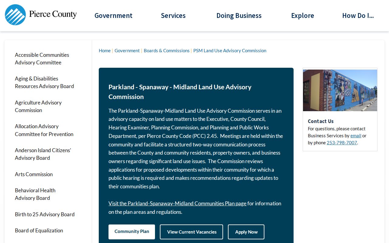
That information is useful for civic questions tied to a block while keeping private neighbor details outside the search.
The Spanaway Lake Management District Citizens Advisory Board provides another public trail through quarterly meetings and project packets. The district was reauthorized in 2026 through 2031 by a 74 percent vote. Such records can identify projects, public agencies, and speakers in a civic setting, but they should never be recast as a resident roll.
Spanaway Neighbors Aren't Voter Lists
VoteWA is for a voter checking their own registration with first name, last name, date of birth, and CAPTCHA. It does not let the public browse everyone near a Spanaway address. Pierce County Elections has a different request form for district, precinct, matchback, and voting-history data. Fees, processing time, and legal use limits apply.
RCW 29A.08.720 permits certain voter lists subject to other state protections. The Pierce form certifies political use and bars advertisements, offers, or solicitations. Voting history records participation, never how someone voted. Address Confidentiality Program participants and other protected voters are excluded or specially handled.
When the goal is to understand a block, parcel geography and public community records are the safer fit. Do not request or republish voter data as a general list of Spanaway neighbors.
Note: A voter file follows precinct and statutory rules; it is not an unrestricted address-by-address community directory.
Official Spanaway Neighbor Records
Official records and commercial neighbor tools serve different purposes. County systems identify their custodian, fields, limits, and copy path. Commercial compilations may merge old addresses, relatives, and names without showing how each fact was sourced. Use them, if at all, only as an unverified lead and never as the final word about a person.
| Source type | Best use | Main limit |
|---|---|---|
| Pierce parcel and GIS | Map adjacent lots and copy stable parcel keys | Taxpayer data does not prove current occupancy or title |
| Recorded document index | Find deed, plat, covenant, easement, and named-party references | An index row is not the filed image or a title opinion |
| Association or civic page | Reach a public board or follow a public project | Not a complete member or household list |
| Commercial compilation | Possible spelling or old-address lead | Source, age, identity, and accuracy may be unclear |
For a meaningful property question, request the instrument or file from its official keeper. For a friendly introduction, speak with the person directly and accept any request for privacy.
Spanaway Neighbor Address Labels
Postal city lines can shift across the Spanaway area. Official local examples use both 98387 and 98444, and some county service locations carry a Tacoma mailing city even when they serve or describe Spanaway. A postal label is a delivery instruction, not a parcel boundary or proof that a record belongs to Tacoma city government.
Keep the USPS address, community name, parcel number, and plat as separate facts. This matters when two nearby lots return different mailing cities or when an older record uses a former street. The Tacoma Buildings Index notes that 102 153rd Street South was formerly Louvre Street South and changed around 1986. Search both strings when a historic block record seems absent.
That local address change is also a warning against joining records by text alone. The legal description and parcel key can bridge old and new labels without assuming the building, household, or lot stayed unchanged.
Privacy for Spanaway Neighbors
Washington law protects more than one kind of personal information. The Address Confidentiality Program gives eligible participants a substitute mailing address and forwarding service, generally for four years. Voter disclosure rules protect participants. Current certified vital records need eligibility and proof. Recorder images may redact sensitive numbers, and courts may restrict or seal files.
Public parcel attributes still do not reveal every occupant. Do not infer family ties, ownership, or present residence from a shared mailing address. If a person asks not to be contacted, stop. If a record looks wrong, report it to the custodian instead of spreading the error.
Lawful use. Research Spanaway neighbors only for lawful aims such as civic awareness, property history, reconnecting, or personal safety. Never use public information to watch, stalk, harass, intimidate, impersonate, or harm anyone.